Field observation concept

Coastal Survey Kit

Measure the same coast, season after season.

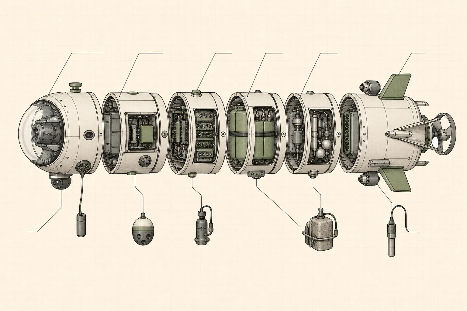
Illustrative schematicProposed shallow-water field system
Illustrative cutaway drawing of a modular underwater survey vehicle with camera, electronics, sensor chambers, fins, and a rear propeller.
  1. Power
  2. Control
  3. Ballast
  4. Sensors
  5. Vision
  6. Acoustics
A proposed arrangement of the vehicle sections for design discussion. This is not a photograph, deployed prototype, or field result.

Coastal teams often know where reefs, outfalls, and habitats are changing but cannot measure them often enough. Coastal Survey Kit would help a local team repeat the same shallow-water route and keep the resulting observations close to the people making decisions.

The ocean is changing faster than local teams can measure it

Most coastal conservation teams know where the pressure is: runoff points, reefs under stress, protected areas that need monitoring, fish populations that are shifting, and habitats changing out of sight.

Teams often lack access to affordable observations that can be collected in the same way often enough to guide a decision.

One serviceable kit, configured for a local question

Coastal Survey Kit is a proposed modular underwater system for shallow coastal environments. Interchangeable sections would let a local team configure the same serviceable base around one field question.

A mission could focus on water conditions, reef imagery, sound, environmental samples, seafloor context, or a careful combination chosen with the field partner.

Repeated observations make better decisions possible

Useful conservation records need observations tied to place, depth, time, and the conditions of each mission.

Repeating the same route could help a local team compare what changed, decide what needs attention, and judge whether an intervention is working.

Intended use

Practical questions local teams could use it to explore

Each example begins with a field need that local teams would need to shape, test, and review before any wider use.

  1. Follow runoff

    Map water conditions around storm drains, river mouths, sewage outflows, farms, marinas, and construction runoff.

    Intended record: A place-based plume map showing where altered water travels and how conditions change after rain, tides, or intervention.

  2. Revisit a reef

    Run repeatable visual transects over natural and artificial reefs using cameras, lights, sonar, and scale references.

    Intended record: Imagery, condition notes, habitat classification, debris detection, and recovery tracking over time.

  3. Look for signs of life

    Combine cameras, acoustic monitoring, imaging sonar, and eDNA to detect visible and hidden life.

    Intended record: Species presence, abundance indicators, size-class estimates, and biodiversity traces through the water column.

  4. Build a local baseline

    Survey shallow coastal seafloors with sonar and navigation sensors to make accessible baseline maps.

    Intended record: Depth models, structure maps, reef profiles, outfall maps, and repeatable survey baselines.

Concept operating flowHow a field mission could work
  1. Choose a local question
  2. Configure the field system
  3. Run a bounded survey
  4. Review observations locally
  5. Service and adapt
A proposed sequence for preparing, running, reviewing, and maintaining a field mission. The final process would be set with a field partner.

Proposed system

Designed to be understood, maintained, and adapted

  • Power and control

    Serviceable power, leak sensing, navigation, communications, logging, and mission control in inspectable sections.

  • Movement and ballast

    Controlled propulsion, buoyancy, and trim for repeat routes through shallow coastal water.

  • Water sensors

    A swappable bay for water chemistry, depth, turbidity, chlorophyll, oxygen, and environmental probes.

  • Imaging and sound

    Cameras, lighting, scale references, and hydrophones for visual and acoustic review.

  • Sampling and mapping

    Interchangeable filtration, sonar, and mapping tools selected for one agreed field question.

Useful records

Intended to leave a clear record for local decisions

If field trials support the approach, Coastal Survey Kit would help teams review observations, decisions, and changes over time in one place.

  • A repeat survey record tied to place, depth, time, and the local question being investigated.
  • Water-condition readings, reef imagery, sound, or samples from the modules chosen for that mission.
  • Locally reviewable maps and notes that make change easier to compare across repeat visits.
Concept review viewPossible local review record
  1. Water conditions
  2. Reef imagery
  3. Acoustic events
  4. eDNA records
  5. Seafloor notes
A proposed review view showing how several observation types could be compared. It contains no field data or measured result.

Safeguards

Local control must shape every field trial

A responsible trial would define who controls the work, what is safe to collect, and how the system can be maintained or stopped locally.

  • Start with one question chosen and reviewed by the coastal team closest to the work.
  • Set pressure testing, launch, recovery, and habitat safeguards before any field mission.
  • Use serviceable sections, replaceable parts, and responsible low-cost materials where possible.
  • Document interfaces, repairs, local substitutions, and pressure-critical parts clearly.
  • Keep access to observations, sensitive locations, and future use under agreed local control.

What support makes possible

What funding covers

Support funds the practical work needed to move from a useful idea to one responsible, locally reviewed field trial.

  • Coastal partner time to choose one useful question, set a repeat route, and review what the survey leaves behind.
  • Mission permissions, habitat safeguards, pressure testing, and safe launch and recovery planning.
  • A serviceable field prototype, the modules needed for the agreed question, spare parts, and local review tools.
  • Hands-on training, repair and substitution notes, maintenance planning, and a clear local handoff.

What comes next

Field partners and funders can shape a responsible first trial

The next step is a bounded field question, clear safeguards, and a local team with the time and authority to review the work.

  • Coastal teams and local stewards

    Define the coastal question, local permissions, launch conditions, language needs, and the observations that would be useful after the trial ends.

  • Marine scientists and field operators

    Set a repeatable route, validate observations, protect sensitive habitats, and decide whether the resulting record is trustworthy enough to guide action.

  • Makers and engineers

    Design serviceable modules, test seals and pressure housings, integrate sensors, and document repairs and safe substitutions for local use.

Next step

Fund a first coastal survey

Funding would cover partner-led mission design, a serviceable prototype, field safety preparation, local review tools, spare parts, training, and clear handoff notes. The first trial would answer one bounded coastal question and test whether the survey can be repeated and repaired locally.